Seitenstruktur
-
Spitsbergen-News
- Select Month
- March 2020
- February 2020
- March 2019
- January 2019
- December 2018
- September 2018
- June 2018
- May 2018
- April 2018
- March 2018
- February 2018
- January 2018
- December 2017
- November 2017
- October 2017
- September 2017
- June 2017
- May 2017
- April 2017
- March 2017
- February 2017
- January 2017
- December 2016
- September 2015
- April 2015
- March 2015
- February 2015
- January 2015
- December 2014
- October 2014
- August 2014
- June 2014
- May 2014
- April 2014
- March 2014
- November 2009
- April 2000
- Select Month
| Grytviken |
Home →
Yearly Archives: 2014 − News & Stories
Ice loss in western Antarctica
Continental ice masses in western Antarctica are believed to be less stable than their counterparts in East Antarctica. Most likely, they are already making a significant contribution to global sea level rise. This contribution may even increase strongly in the future. One reason is that ice masses in western Antarctica rest on the ground below sea level over large areas. Loss of shelf ice, which has a stabilizing effect on glaciers in the catchment area, are another factor.
The ice loss has now been examined and confirmed with 4 independent methods. Earlier studies focussed on one method only, leaving the possibility of undetected methodical errors. This risk is eliminated by using 4 independent methods. These are laser and radar altimetry time-variable gravity, surface mass balance, and radar-based ice velocity and ice thickness measurements. All methods confirm the ice loss and its acceleration in recent years.
Over the whole study period from 1992 to 2013, the ice loss is measured at 83±5 Gt/yr (billion tons per year), with an acceleration of 6.1±0.7 Gt/yr2. Looking only at the more recent years 2003-2009, the resulting ice loss is 84±10 Gt, no significant change. But the acceleration has almost tripled to 16.3±5.6 Gt/yr2. Including 2 more years, looking at 2003-2011, yields a higher ice loss rate of 102±10 Gt/yr and an acceleration of 15.7±4.0 Gt/yr2.
The increase of acceleration is reason for concern. Currently, continental western Antarctica ice masses are estimated to contribute with 0.3 mm/yr to global sea level rise.
Icebergs in Antarctica.

Belorussia plans Antarctic station
Belorussia wants to add yet another one to the already impressive number of stations in the “untouched” wilderness of Antarctica. Work is planned to commence in 2015, and in 2017, the new station is scheduled to be largely operative. An agreement about a scientific and logistical cooperation was signed in St. Petersburg in the presence of the presidents Putin and Lukaschenko.
The new station will be situated at Mount Vechernyaya in Thala (Tala) Hills, in Enderby Land, East Antarctica.
A permanent presence in Antarctica is necessary for a country to enjoy full member rights in the Antarctic Treaty system.
Russian station Bellingshausen in “untouched” antarctic nature. Belorussia is now planning yet another station.

Source: Belarusian News
Feather-loss disorder observed in antarctic penguins
The feather-loss disorder is an avian disease that leads to the loss of part of the plumage. It has been observed on a number of occasions in penguin colonies in South Africa and South America since 2006. Little is known about the disease. It is not even understood if it is caused by bacteria or viruses.
In January 2014, the feather-loss disorder has, for the first time, been observed in Antarctica. The Adelie penguin colony in Hope Bay, on the northeastern Antarctic Peninsula, is one of the largest of its kind in Antarctica, with about 120,000 breeding pairs. It is routinely censused every week by personnel from the nearby Argentine station Esperanza. In January, one chick, about 15-20 days old, was found with partly missing plumage, exposing parts of the skin. The remaining feathers were easily blown away even by wind gusts. Lice or other influences were not observed. The chick died 2 days later.
Another chick was subsequently found in another part of the colony, about 1 kilometre away. This second affected chick could, however, not be investigated in any detail, as it disappeared and did not come back. Presumably, it died soon.
No other affected penguins were observed. It seems accordingly that the feather-loss disease does not spread easily; it is possible that it affects only penguins with a suppressed immune system or a genetical disposition.
It is unknown how the disease came from South Africa or South America to Antarctica. The risk of further spreading is also completely unknown. It seems, however, likely that staff from base Esperanza who had been in touch with penguin colonies in Argentina may unintentionally have brought the disease with them. Tourism might be another vector, but it is compulsory for tourists to disinfect boots and to clean clothing and other equipment carefully before arrival in Antarctica and any landing there, to prevent spreading diseases or alien plant species.
Adelie chick with feather-loss disorder. Hope Bay, Antarctica, January 2014. Photo: Andres Barbosa.

Source: Antarctic Science
Quantarctica: free GIS to make antarctic research data accessible for all
Scientists are constantly gathering large amounts of data in and about Antarctica. But how can the public access and use these data? The Norwegian Polar Institue has made an effort to make scientific data from Antarctica accessible for everybody by publishing Quantarctica” title=”Quantarctica” target=”_blank”>Quantarctica, a free open source GIS (geographic information system) to compile antarctic scientific data. The system is based on Quantum GIS and has data within oceanography, atmospheric science, geology and biology.
As soon as the software is installed, it is possible to use Quantarctica offline.
Scientific users can also upload their data to publish them quickly to a wide public.
Quantarctica (Screenshot): free open source GIS with scientific data from various research branches in Antarctica.
")
Source: Quantarctica
Volcanic activity under Thwaites Glacier contributes to melting
The Thwaites Glacier in West Antarctica has recently attracted considerable media attention, as scientists have predict it to collaps largely in the future. It is up to 4 kilometres thick and large enough to contribute with 1-2 metres to global sea level rise – a dramatic value. So far, warm sea water has been made responsible for glacier melting on the coast, but now there is evidence that a significant part of melting actually takes place at the glacier base, away from the coast. Thwaites Glacier is largely based well below sea level, as is the case for large parts of the West Antarctic ice shield, a fact that contributes to its lack of stability.
Timing and duration of a collaps are, however, currently unknown, even though it seems widely accepted amongst scientists that a collaps is very likely. But one of the main influences on glacier dynamics were so far unknown: the geothermal heat flux from the underlying crust to the glacier ice. Until now, it has been believed that geothermal heat transfer is evenly distributed over the area of the underlying crust.
Scientists of the Institute for Geophysics of the University of Texas at Austin have now revealed that this is anything but the case. Subglacial meltwater movement under the Thwaites Glacier was mapped with radar-based methods. The result is that meltwater production is very unevenly distributed. This can be used to calculate the geothermal heat flux under the glacier, which reaches values up to 200 milliwatts per square metre while averaging near 100 over the whole area. In comparison, the average value for all continents on Earth is just near 65 milliwatts per square metre.
These values of geothermal heat flux are considered “significant” for glacier and ice sheet dynamics. The Thwaites Glacier is accordingly loosing large volumes of ice due to melting at its base. The geothermal heat flux is not influenced by climate changes, as opposed to melting that takes place near the coast, in the contact zone with sea water which is getting increasingly warmer.
It is the geology which is responsible for sub-glacial melting. Western Antarctica is geologically active. Scientists believe there is a rift system under the ice, similar to the Rift Valley of east Africa. This rift system involves increased magma movements in the crust and possibly volcanism at the glacier base, similar to volcanoes in Iceland.
Don Blankenship, scientists of the University of Texas and one of the author of a recently published study, described the Thwaites Glacier as follows: The glacier “sits on something more like a multi-burner stovetop with burners putting out heat at different levels at different locations. … And then you plop the most critical dynamically unstable ice sheet on planet Earth in the middle of this thing, and then you try to model it. It’s virtually impossible.”
But of course scientists are trying to model the Thwaites Glacier to predict its future dynamics. The new knowledge about geothermal heat flux under the glacier will be a very valuable contribution to new models.
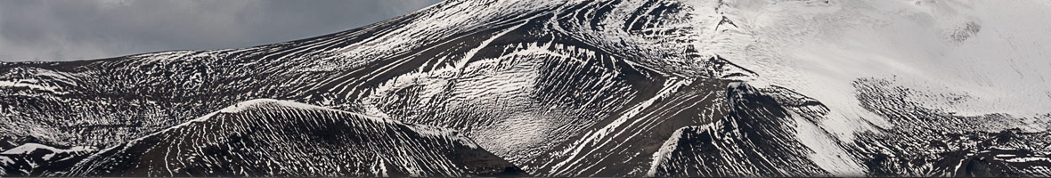
Glacier in the Antarctic Peninsula: a dwarf compared to the Thwaites Glacier.

Source: University of Texas
Japan wants to continue whaling in Antarctica
They can’t just let it be: Japan’s conservative prime minister Shinzo Abe has declared to plead for a continuation of Japanese whaling. In early 2014, the highest UN court had declared Japanese whaling in its current form for illegal, as it is declared as scientific whaling, but is far from meeting any requirements to qualify as such. The verdict has, however, left the possibility open to organize a new whaling programme that could meet the requirements, which include a stronger focus on non-lethal methods and relevant publications.
Abe is quoted saying that he wants to strengthen scientific research on whale populations and thus achieve new commercial whaling – remarkable how “scientific” and commercial whaling are connected in the perspective of the Japanese government. Abe also expressed it is sad that eating whale meat is not internationally recognized as part of Japanese culture. This part of Japanese culture does, however, enjoy only limited popularity even in Japan: demand for whale meat is lower than supply, despite commercial and even governmental promotion.
Minke whale in the Antarctic Peninsula. In 2005, Japan killed about 3500 Minke whales for “scientific purposes”.

Source: Spiegel online
Uplift of the northern Antarctic Peninsula: result of tectonics and ice loss
The process of land uplift as a consequence of loss of large ice masses is well known from northern Scandinavia and Spitsbergen, where traces of such events including raised beaches can be seen in many places. In Antarctica, it is more tricky as there is not much ice-free land.
Precise GPS-measurements have revealed recent uplift dynamics of the northern Antarctic Peninsula. And not just that: while uplift was almost negligible with 0.1 mm/year until 2002, the value jumped up to 8.8 mm/yr – an increase by a factor of almost 90! This is remarkable, both in terms of the development and the absolute value of present land uplift: nearly 1 cm/year is very fast, geologically speaking.
The collapse of the Larsen B ice shelf in 2002 has been assumed to be the main driving force behind the land uplift: immense volumes of floating shelf ice broke off the east coast of the Antarctic Peninsula and floated out into the Weddell Sea as large tabular icebergs. The loss of formerly land-based was a consequence of the loss of the stabilizing ice shelf. The result of such an immense loss of weight is isostatic rebound of the crust, leading to land uplift.
Geophysical modelling has now shown the ice loss to be insufficient to explain rate and development of land uplift as observed. Movements in the mantle, at 100 km depths and lower, need to be taken into account to explain the data fully.
The Bransfield Strait, a small oceanic basin separating the South Shetland Islands from the northwestern Antarctic Peninsula, is a tectonically active area. There are several volcanoes in the area that erupted very recently in geological term, and several fracture zones and plate boundaries.
Penguin Island: a young volcanic island in the geologically active Bransfield Strait. Next to volcanism, land uplift is another consequence of these tectonics, amplified by recent deglaciation of the Antarctic Peninsula.

New statistics for tourism in Antarctica
The International Association of Antarctic Tour operators has published new statistics of tourism in Antarctica. Numbers for the now finished 2013-14 season are not finalized yet, but preliminary figures indicate a stable development without major changes from previous years. In the 2012-13 season, a total of 34,316 tourists visited Antarctica, a figure not expected to change too much for 2013-14. According to a prognosis for 2014-15, expected visitor numbers of 36,545 indicate a future growth of 6-7 %.
There have not been large fluctuations since 2009-10: visitor numbers have largely been stable between 34,000 and 36,000, with the exception of the 2011-12 season, when numbers dropped down to 26,500 following the ban on heavy oil as ship fuel in the Antarctic Treaty area. As a consequence, some larger ships dropped Antarctica as a destination. A good development from an environmental perspective, considering the potentially dramatic consequences of a spill of heavy fuel/crude oil.
Out of about 35,000 tourists visiting Antarctica, a large majority of 71 % is travelling to the Antarctic Peninsula with small to medium-sized ships with fewer than 501 passengers. These ships offer landings to their passengers. As the maximum number of tourists ashore is limited to 100, ships with more than 100 passengers offer a rotation system.
Ships with more than 500 passengers do not offer landings, they constitute the “cruise only” category, which describes exactly what they are doing (and what not). 27 % of antarctic tourism is cruise only.
The proportion of those who visit the interior of Antarctica by flight is small, numbering about 1 %. This includes visits to the South Pole and mountaineering expeditions to Mount Vincent, the highest mountain of Antarctica.
Expedition cruise ships at the South Shetland Islands: this is how most tourists visit Antarctica. MS Nordnorge to the left, MV Grigoriy Mikheev (not operating anymore) to the right. A governmental supply ship in the background.

Source: IAATO
Article about Ross Sea voyage published by Dale L. Jacobsen
Dale L. Jacobsen is a well-known author in Australia and participant on the voyage into the Ross Sea on board MV Ortelius in February 2013. She has written an article about her antarctic adventure which is now published on Travelosophy. A book is in preparation.
Taylor Valley, one of the famouse McMurdo Dry Valleys, visited during the above-mentioned voyage 2013, described in Dale L. Jacobsen’s recent article.

Macquarie Island free of rats, mice and rabbits
Macquarie Island is 1500 kilometres southeast of Tasmania and belongs to Australia. For decades, the once so rich seabird populations of the island have suffered strongly from introduced rats, mice and rabbits: eggs and chicks were stolen from nests by ten thousands, breeding habitat was destroyed, namely tussoc grass, and even a landslide that wiped part of a King penguin colony out is said to have been caused by erosion on a slope deprived of its vegetation by rabbits.
In 2007, the governments of Australia and Tasmania launched a project of 17 million Euro to eradicate the unwanted species and turn the island back into its natural state. During a first phase, poisoned bait finished most of the aliens off. In a second phase, hunters with dogs made sure not a single rat, rabbit or mouse survived. A two year control phase has now confirmed the successful completion of the project.
The eradication of feral cats, which had devastating effects on the seabird colonies, was already completed in the year 2000.
The Macquarie Island project is the largest of its kind so far, and it is followed closely by organizations running similar projects on other island. The currently largest and most challenging project of this kind is the ongoing rat eradication project on South Georgia.
Macquarie Island is now officially rodent free.

Source: ABC News
“Scientific” whaling sentenced by International Court of Justice
A recent sentence by the International Court of Justice in The Hague may not have stopped Japanese whaling in Antarctica finally, but it has at least given it a serious legal blow. It is now established by the highest international court that Japanese whaling in its current form (!) is not covered by exemptions for scientific whaling as defined by the International Whaling Commission.
Japan is issuing licenses for killing whales despite a moratorium against whaling of 1986. Japanese authorities claim scientific reasons, but the killing of about 3600 whales has resulted in only 2 peer-reviewed scientific publications. According to the Court in The Hague, this is not sufficient to justify the number of whales killed.
Each year, Japanese authorities issue licences for more than 1000 whales to be harpooned. Most of these, about 950, are Mink whales, followed by Humpback and Fin whales with about 50 each. These numbers have often not been completed, thanks to the activities of international environmentalists such as Sea Shepherd.
According to the recent sentence, Japanese whaling is clearly against the 1986 moratorium on whaling. Younger history has shown in many cases that international law does not keep governments from doing whatever they want, but Japanese officials have announced that they want to respect the sentence. This may, however, also mean that the current whaling programme may be replaced by a new, “scientific” one. If so, the new one would, at least, include a significantly reduced number of whales to be killed and more non-lethal research efforts. Time will have to show if such a programme would be attractive enough for Japanese whaling ships to take the long trip into Antarctic waters. The current author strongly believes that certainly the whales and the marine environment, but also the reputation and credibility of science in general would benefit from a complete stop of Japanese (and other) whaling.
Humpback whales in Antarctica: not yet safe from Japanese harpoons, but there is hope.

Source: Spiegel Online
News-Listing live generated at 2024/April/19 at 02:50:31 Uhr (GMT+1)
-
Books, Calendar, Postcards and more
-


